1: No X Marks Any Spot – the base map
I am not a developer. So I am always thrilled when some tool arrives or gets updated that seems to take grunt work out of creating features that seem – to me – obvious and ridiculously easy, but that in game dev country usually are just the entry to some rabbit hole. So when the Unreal Engine presented modelling their landscape and water bodies with spline shapes, I thought: great! No need for messing with brush sculpting or looking for good water shaders!
Hence me, saying to a pal, »I’ll go and play with the new Landmass and Water System, and, just for funsies, recreate a certain Island of Monkeys, deep in the Caribbean, so that we can walk around on it!«
I had never done a map. I had used Unreal to see what of my VFX work could be done in there, and which of its ICVFX features could help my own filmmaking projects. This would later bite me in the butt massively, but hey, we all start out naïve, don’t we.
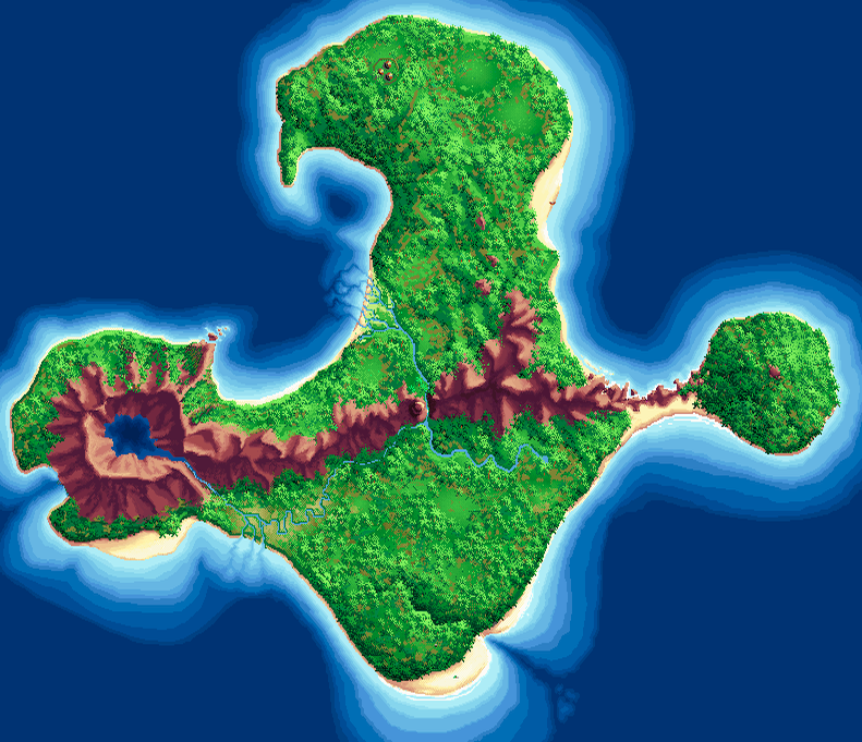
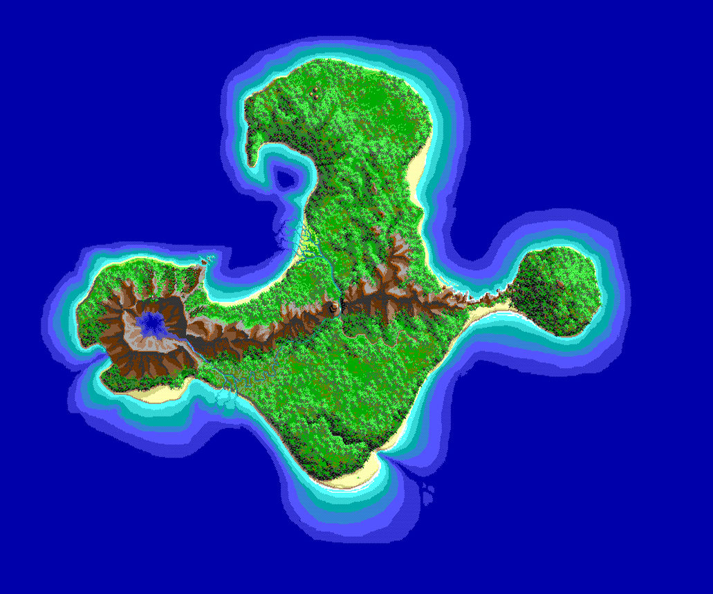
But: map. To make a map, I needed a reference map, and of this particular fictional island there exist at least three versions:
- one of the VGA version, which is the one I played first and therefore love most
- one of the EGA version, which – according to Frank Cifaldi’s (of Video Game History Foudadion) awesome behind-the-scenes article – is the most complete (it provides more under-water shore falloffs [I will go on and on about shore falloffs, which are – for some reason beyond my reasoning capabilities – ridiculously important to me, to the point where even the most patient and the well-disposed reader my want to tell me to finally shut the f* up about shore falloffs])
- and one of the Special Edition, which does not provide additional detail [I do not love the SE anyways, because it changes the graphic style too much and seems a bit sloppily done [as evidenced, for example, by too obvious stencilling of palm trees on the map], and – and here it gets really old-school nerdy narrow-minded – all text-based jokes like the ™ on various items (the shovel Digmaster™, Melée Island™ etc.) get lost in the voice version. What I would have loved, though, because it is very much less intrusive, would have been a mode to use the VGA graphics [maybe including the sunset of the EGA version], text-only, but with the rich sound design of the SE. (Grumblingly, I must give it points for consistency, though, for presenting the retro look with the retro sounds …)]
So, got a map, back to making a map! Easy, I thought:
- Create a landscape in the engine,
- map the original map on top of it,
- sculpt the mountains and rivers and shores with non-destructive Blueprint Landmass and Water brushes only;
- auto-populate with palm trees,
- and add all the nice little details: the Second-Largest Ever Monkey Head, the cannon at the fort, the Cannibals™’ huts, the oars in the ravine, the row boat, and a couple of memos lying around.
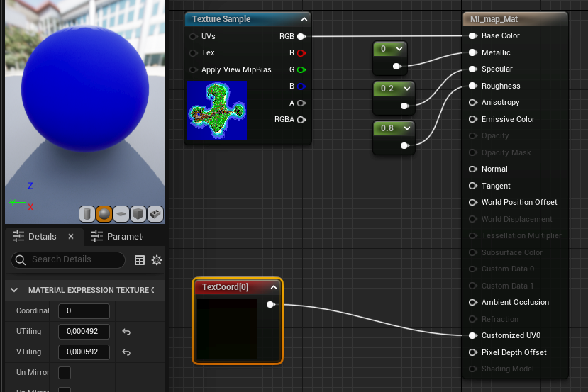
So I created a landscape, made it roughly the aspect ratio of the reference map, and created a landscape material from the reference map as texture file. (To make the texture fill the landscape, the trick here was to add a TexCoord node to a custom UV channel of the material [alternatively, one could –easier – just plug in those TexCoords into the UVs pin of the Texture Sample]. The tiling values are ( 1 ⁄ landscape width | 1 ⁄ landscape height). [I messed it up and therefore can’t look it up anymore, and in a new project I don’t get to match texture and landscape at all. Currently I don’t know how to do it.])
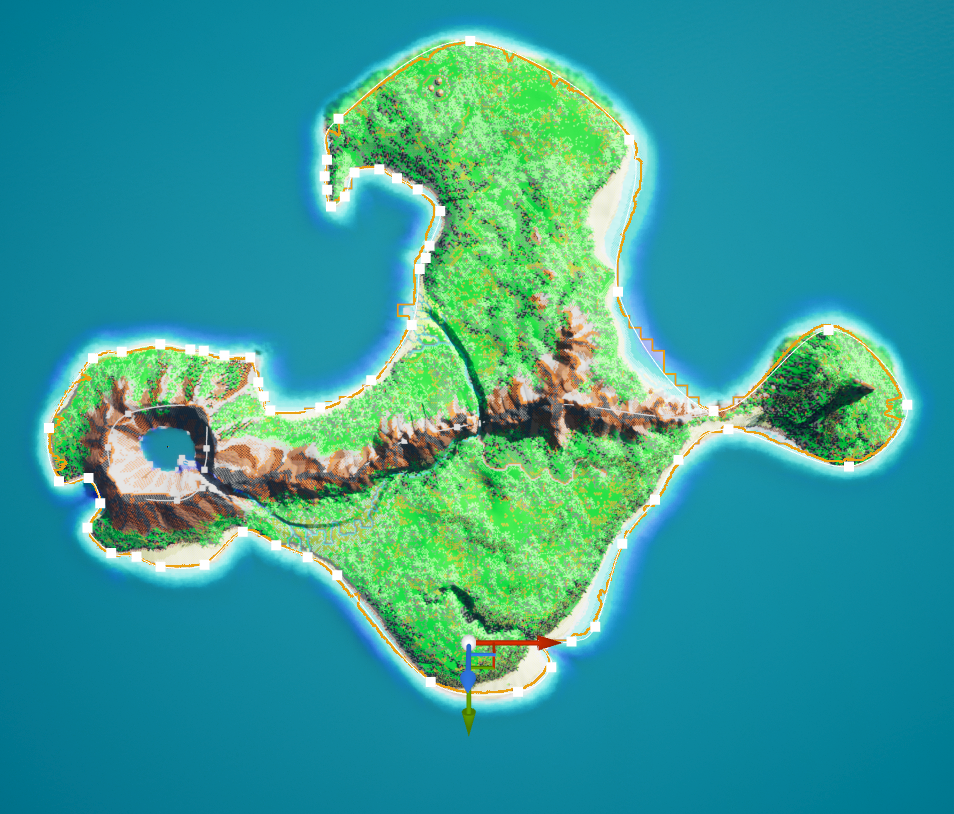
Above: a rough outline of the island’s shoreline (after extensive fiddling with »WaterBodyOcean – Water Heightmap – Falloff Settings«). At this point I am not happy about the uniform beach falloff into the water – when you compare it with the reference map, especially the »south« beach [more on the quotation marks in a future post] seems to fall off less steep [and the next post will deal a lot with that] – but for now I added a WaterBodyLake in the volcano, a WaterBodyRiver from there across the island [also more about that in a future post], and some CustomBrush_Landscapes for the mountains. And a bit of traditional brush sculpting.
(There is also an ugly bug on the Monkey Head peninsula, where my manual sculpting only continued to raise the terrain up rapidly to truly stratospheric heights, which I couldn’t really control any more.)
And that is where I stopped :
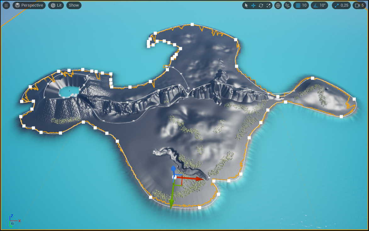
Because, y’know, the shore falloff bothers me, also my ridiculous attemps at getting any acceptable Curl noise added to the mountains, and wouldn’t it be much nicer anyway if I would put in just a little bit of effort to use a landscape generator to create some more geologic-looking mountains and volcano lake?
Get Study: Island of Monkeys terrain (v1)
Study: Island of Monkeys terrain (v1)
De- and reconstructing a certain (probably trademarked) island, deep in the Caribbean
| Status | Prototype |
| Category | Assets |
| Author | Cinewulf |
| Tags | 3D, Casual, Exploration, Fangame, First-Person, heightmap, landscape, monkey-island, Singleplayer, Walking simulator |
| Accessibility | Textless |
More posts
- Conclusion: How Not To Create A Playable MapFeb 13, 2022
- 4: A Profusion of Banana TreesFeb 13, 2022
- 3: The Rivers Run Dry – landscape and waterFeb 01, 2022
- 2: Eroding To A Target – terrain creationJan 27, 2022

Leave a comment
Log in with itch.io to leave a comment.