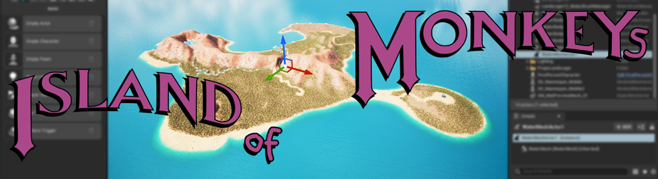
Study: Island of Monkeys terrain (v1)
2: Eroding To A Target – terrain creation
So I got a first iteration landscape, but I’m not an environment artist. Having a father who is into model trains, and therefore being exposed to scale models, and myself liking to think of the world in various abstract models, and also maybe by repeatedly reading Kim Stanley Robinson’s Mars trilogy with its relative profusion of geology (or, in that case, »areology«), and despite totally disliking my former favourite scifi author Neal Stephenson’s Reamde (but loving the idea of creating an MMORPG with a physically-accurate geology), I picked up a liking of models and model landscapes.
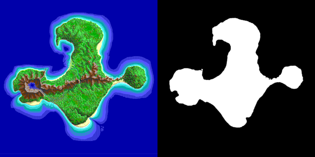
Let’s have a look at the map again:
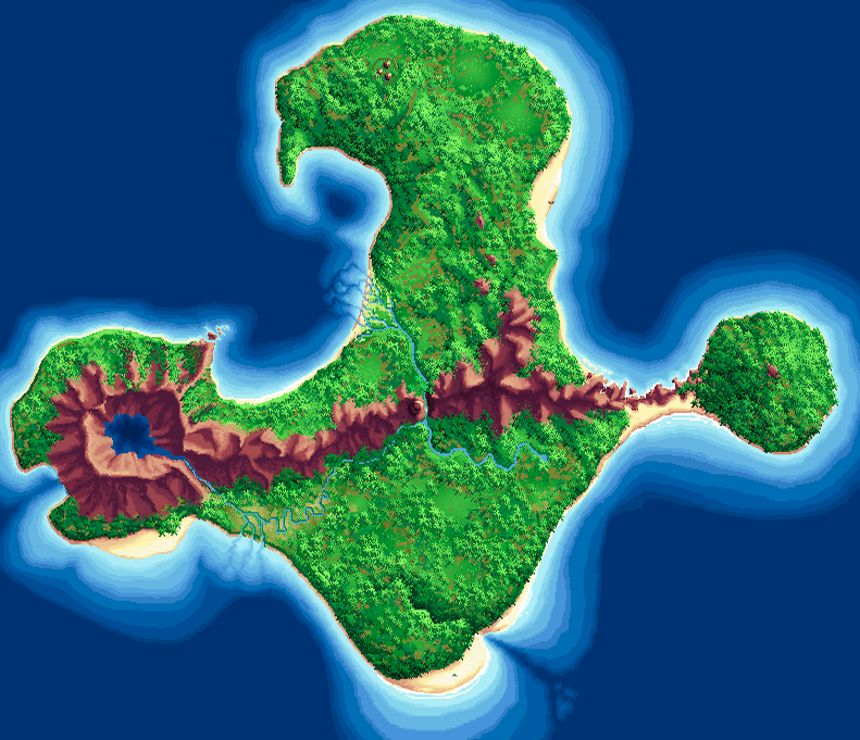
What is there:
- Apparently, the beaches on the bottom are wide and gently slope into the water,
- while the river deltas do not seem to carry too much sediment as the coast there is averagely steep.
- There’s a lake in the volcano that feeds a river … which only partly empties in the ocean nearby (bottom left) and the rest [gravity, anyone?] runs across the whole island –
- cutting a steep gorge into the mountain range (however it managed to do that)! –
- before finally emptying out in the upper half.
- The mountain range starts at the volcano like lava overflow (?) but continues all across to the Monkey Head peninsula on the right.
- The mountains in the center of the island are highest, which makes sense when the island is a pile of stuff reaching out of the ocean. (Although, let’s not forget, there is a lot of lava under the island, so it should be a volcanic island. Maybe magic has pushed the lava higher up in the middle of the island …)
- There is a crack / rift / gorge in the lower part that extends into the ocean to the lower right – but which at the shoreline has somehow filled up enough that the water does not seep into the inland part.
- Oh, and very interesting: what is that notch on the far left at the volcano? Can this have formed naturally? The shore falloff seems to indicate that – for an artificially dug canal it’s way to wide and gently-rising – but how could that have happened? If there is a hidden cave that leads to the underground anchoring point of Le Chuck’s ghost ship, it is there! (How does the transition from ocean to lava look like? Is there a curtain of violent steam? …)
Geology Rocks
A layman’s explanation of geology:
When you see a mountain, that mountain has formed a lot more organic or fluid than might be obvious. And while it is being pushed up, it gets eroded – heat cracks the rock, wind sands the edges as does water, which also fills in cracks with deposits.
Spoiler: With a (to my knowledge) geologically at most medium realistic landscape like this fictional island, where you then even cover most of it with jungle ground cover and foliage, worrying about realistic mountain shapes is kind of overkill. But a) I didn’t realize that back then and b) I loved to play around with terrain creation anyways.
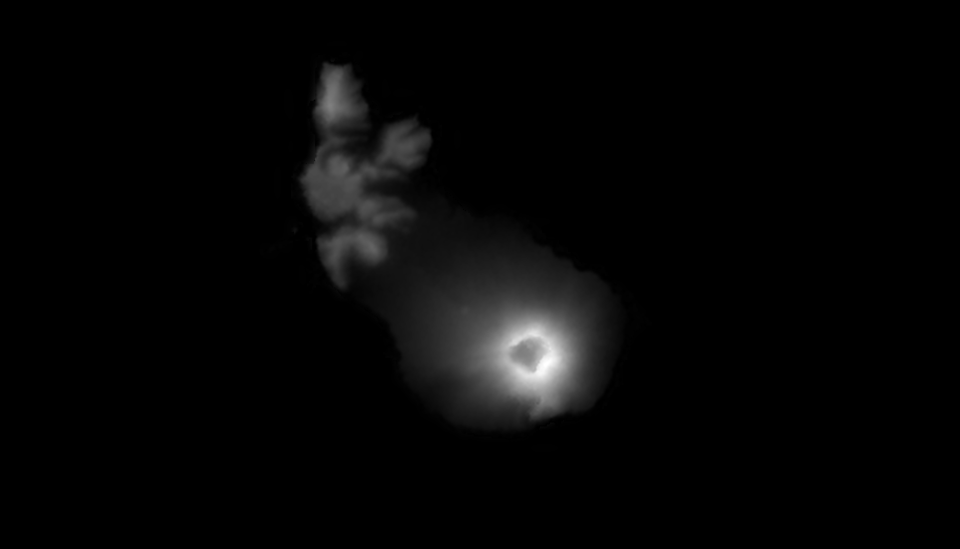
First I think that there’s nothing better than reality. There’s a volcano on the Island of Monkeys, to I’m going to look for an isolated volcano on a Caribbean island. Some googling gives me The Quill on Sint Eustatius in the Caribbean Netherlands. Way too big, but I can probably scale it down. On Tangram Heightmapper, from where I download a heightmap, it looks like this:
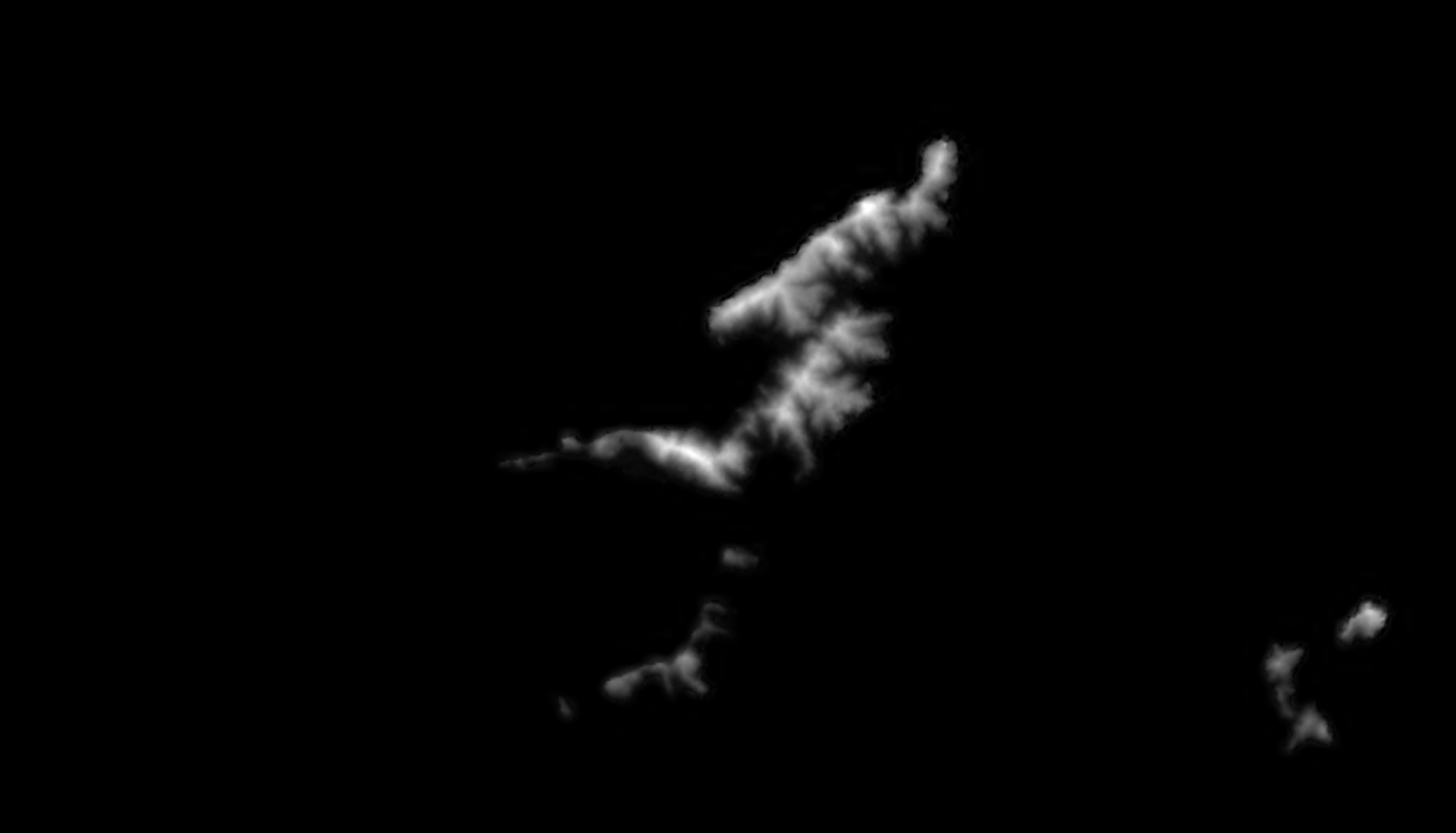
An some more mountains / hills on islands in the general vicinity:
(So a heightmap is simply a grayscale image where usually bright represents »higher« and dark »lower«. If you want to avoid awfully blocky results, those heightmaps must have 16 bits of color depth.)
But I soon lose interest in trying to patch this together with some yet-unfound mountains etc. because it appears quite problematic to blend those sprites together to a decent heightmap.
Let’s Generate Everyting Digitally!
Creating a landscape in a digital terrain creation or »terrain design« tool usually starts by bumping up a plane with some noise like Voroni. After that one applies a combination of filters that simulate erosion. And you end up with stuff that looks quite natural. (Unlike, for example, the mountains in all of ARK: Survival Evolved, which really bugs me, but now knowing more about map design I can acknowledge that this process is not easily joined with realistic geology.)
There are three terrain creator tools I know about: World Machine, World Creator and Gaea. The last one has an easy interface, but the first one (although through an antique-looking UI) lets me draw initial shapes (in contrast to only working with initial noise). World Creator seems to have both, but of that there is no free demo version, and since I’m new to this, I tried the free versions of Gaea and World Machine.
In both, one chains some nodes together – like: initial shape, some erosion, some other erosion, some more erosion – to create shapes. I separated the landmask from the reference map …
… and used that as height input and eroded it …
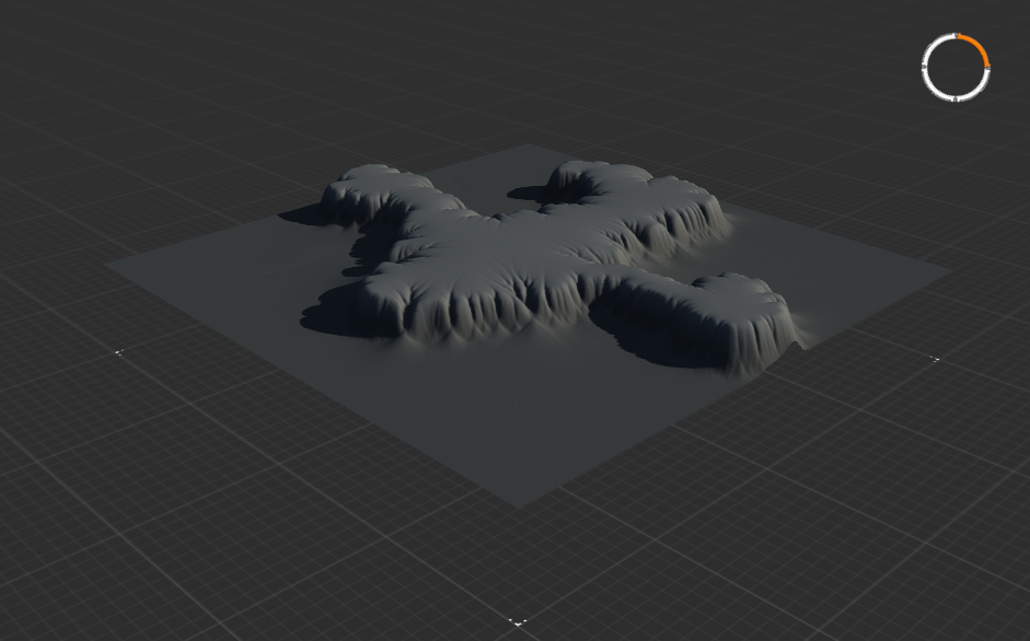
Meh.
I need the erosion to soften the shoreline into soft beaches instead of steep cliffs, but the erosion also erodes the general shape of the island:

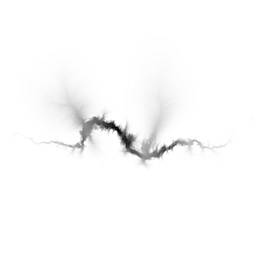
Therefore I changed tack and thought I would just create single features and combine them on the landscape in the engine …
… and got myself some heightmaps like this (for the fault in which the oars lay, and which I distorted in Photoshop to closer match the shape) with the plan to use as a landscape sculpting brush:
My Infamous Shore Falloff
But I was annoyed by my inability to filter my nodes to a decent basic island shape that I liked.
Then I thought: »Hey, these heightmaps are just grayscale images. I have a reference map where I see the deeper sea floor and also the shoreline. I can just trace both, make a gradient between them, and have a hand-drawn heightmap of the underwater shore falloff I want!«
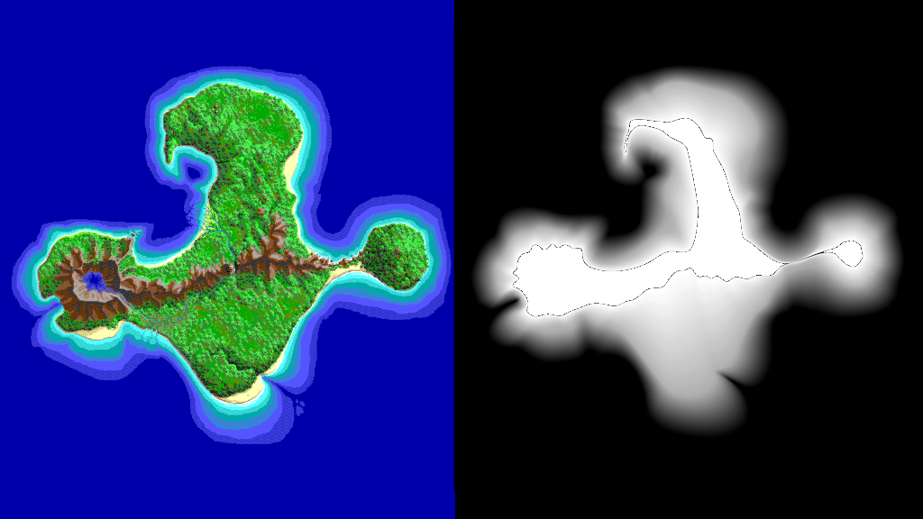
Tracing both outlines is easy. But making a gradient between them? Okay, let’s go into the vector graphics programs!
But apparently, Adobe Illustrator can blend between objects, but can’t export 16-bit color depth (which one needs for a useable heightmap). Inversely, Affinity Designer can export 16-bit, but can’t blend between objects! … Back to Blender!
So, tracing the outlines a third time with NURBS, connecting them and filling them, and finally I got something like this:

(Maybe a bit hard to see, because I also filled quite a bit inland [only the parts I considered basically »plains«], but outside dark is low, and bright is high. The black cutout in the center I’ll fill in later.)
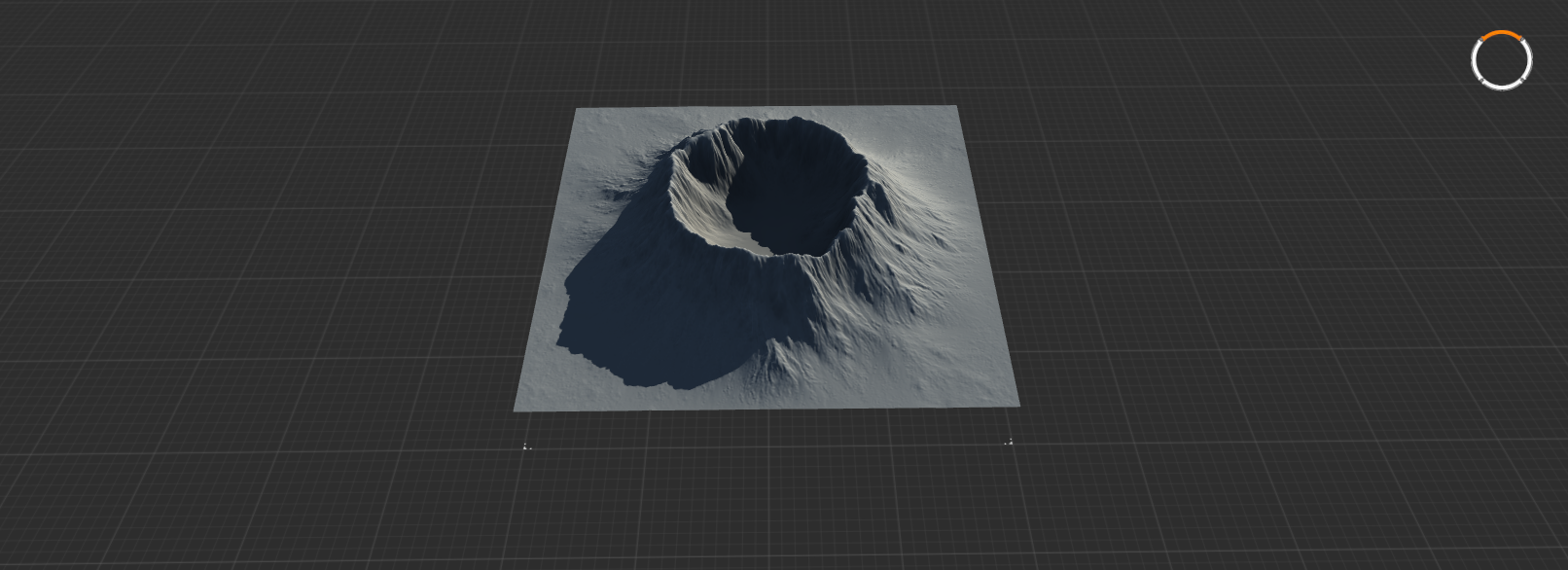
Then, again in Photoshop, I traced the mountains off the original map …
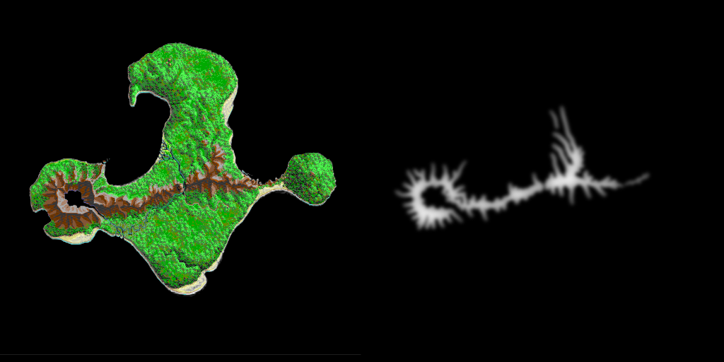
… and piped them into World Machine to generate and erode me some mountains, and after that I put everything together back in Gaea. (Don’t ask me why I switched programs so often. I assume that this or that felt easier in each.)
This is what came out:

Not too bad! With water level, like this:
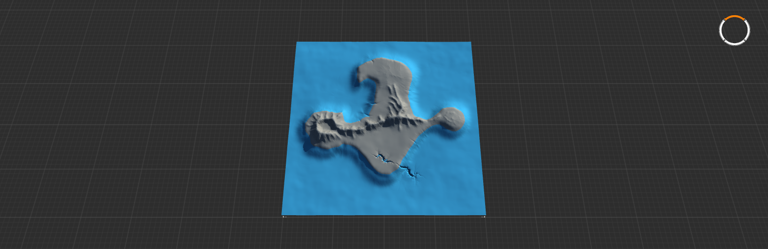
Nice, I think. And still nice after I brought this into the engine.
Leave a comment
Log in with itch.io to leave a comment.