Study: Island of Monkeys terrain (v1)
3: The Rivers Run Dry – landscape and water
(Before we go into the Water System, let me say that I am neither a landscape designer nor a hydrologist.)
The Shape of The Island
So I got a more or less reference shape-conforming landscape eroded.
And when I import this into the engine, everything is fine (apart from it being a bit soft, because the free version only lets me export a 1k texture [but then again, the relationship between landscape resolution and heightmap resolution still eludes me]). But I don’t want to worry about water shaders, and have lake and rivers and ocean all connected, so I am still planning to use the Water System. But the WaterBodyOcean modifies my landscape: It wants a shoreline, makes its own ramp of the landscape to the shore (you can see that uniform-width rim around the shore in the picture below), and then also kind of discards everthing below the water level and replaces all my painstakingly modelled underwater falloffs!

(Epic’s Sjoerd de Jong describes a hack around that in this video, but I’m not there yet to implement that.)
Before we come to the river deltas, let’s back up for a second:
Aside: Topographic Features
I started out – and so far have only discussed – modelling the island based on its map. Since it’s not the territory, there is another approach of course, too: model it by its experience. Which in this case would mean: model it by what a character (and the player) sees.
There are a couple of scenes that show Monkey Island™ from those points of view, and show some distant features which give clues about the larger topography of the island, but which – like a movie setting that is puzzled together from different locations – I struggle to align with each other.
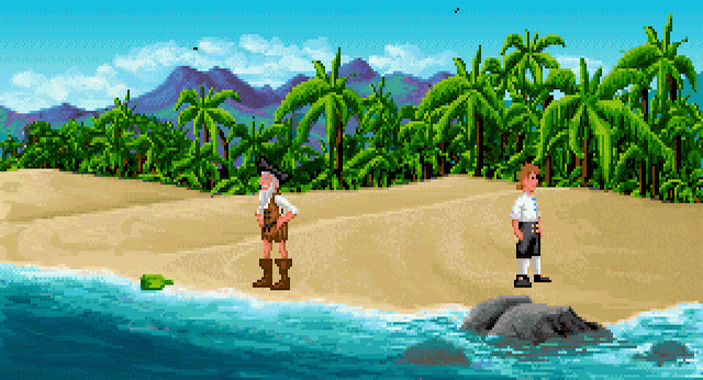
»When one looks«, the cartoon professor inside me intonates, »at the place from above (i.e., the map, which I treat more as a satellite image instead of a somewhat abstracted map) and selectively blurs features – and disregards probable differences in the foliage’s coloration and takes all color difference as indicating hillshade – one can imagine to start to see the dips and hills.« (A smartass can also determine that this map is not north oriented, because the sun seems to come from the top right, and this smartass knows that the Caribbean is north of the equator. But since you, kind reader, and I want to communicate, I’ll still call the shore on the bottom of the map [the one with the lone banana tree] the »south« beach.)
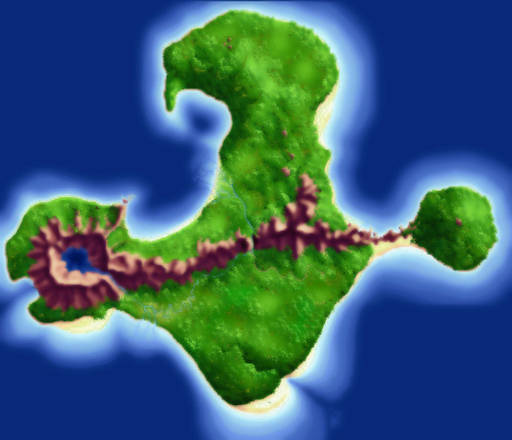
Just above the center, the mountains seem to continue as hills. The rift on the bottom seems to be embraced by bulges. The area between it and the mountains seems quite flat, with only slight undulations.
So let’s check what the »camera« saw [although – and this a really inconsequential aside here – for me personally games are not movies, and therefore there is no »camera« (which might collect dust and water drops and lens flares, and where the picture also cannot have any grain), but rather a physically »perfect« vision of whichever perspective (third-person or first-person) the player experiences]:
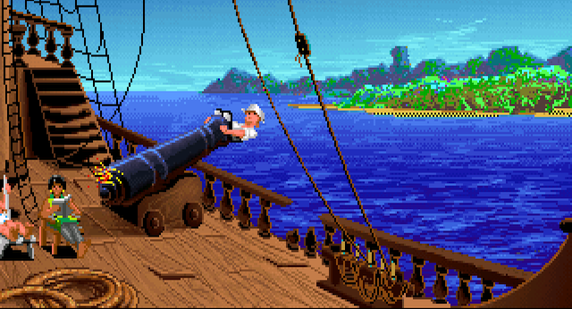
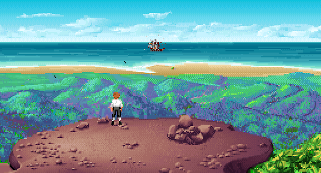
Judging by the ship’s position as seen from the island’s top, and by the beach Guybrush will land on, it follows that directly above Guybrush in this picture should be the volcano, although here I wouldn’t have recognized it. The lone tower-like mountain to the right of the two rigging lines right of Guybrush would make sense to represent the island top (from where you drop your boulder projectiles), yet it seems unnaturally … towering. At least until you see that it indeed towers:
The background mountains show great height variation and seem – even allowing some haze – high and quite a distance away, and again appear more leafy than bare rock.

Looking towards the Cannibal’s island’s part (judging from where Herman’s fort is on the map), the (foot-) hills more or less match the assumed extension of the mountains.
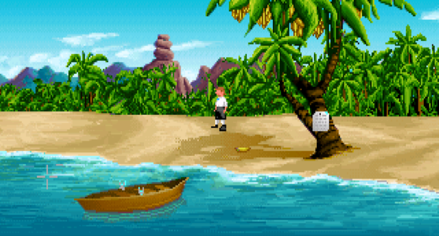
The terrain between the mountains and the »south« shore appears quite hilly. Note the apparent scale mismatch between the jungle-covered middle ground hills and apparently larger-than-a-hill ship and the lone palm tree on the beach, which we know to be only 3 to 4 Guybrushes high: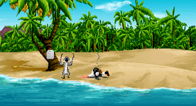
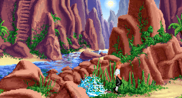
The gorge seems to strech for quite a distance.
Speed Limit?
Bottom line? The island looks larger for a ground-level spectator than it does look for the bird’s eye map viewer.
In this version, my island in the engine measures about 1.7 km (1.1 mi) across at its widest (= Volcano »west« shore to Giant Monkey Head »east« shore). To walk that with the engine’s default maximum walk speed (of »600«) takes me 4 minutes 50 seconds. That means my characters is running at 21 km ⁄ h (or 13 mph or 5.86 m ⁄ s). [For comparison: sprint world record holder Usain Bolt was apparently twice as fast.] But those 5.86 m ⁄ s are interesting: that’s 586 cm ⁄ s, so the »max walk speed« variable apparently defines cm ⁄ s. Good to know!
But the same walk in The Secret of Monkey Island™, as far as possible, takes Guybrush only 32 seconds (or, when avoiding the POI targets [which cause him to run], 1 minute 2 seconds at most)! [If Monkey Island™ were as large as my model, he would beat Usain by being 4 times as fast. Like, German autobahn speed with a reckless driver. On jungle terrain! So either Guybrush is a physical superhero (his 10 minute breath holding thing already impressive), or Monkey Island™ is smaller.
Much smaller. …
How small? Glad you asked! Google throws a result that claims the average walk speed to be 4–5 mph, or around 7.25 km ⁄ h [that is around 2 m ⁄ s, which is quite high (research [footnotes 1–3] shows an average walking speed to be only 1.42 m ⁄ s), but we’ll want to assume a high speed as will be immediately obvious]. In 62 seconds, Guybrush would walk about 125 meters or 136 yards or 400 feet far. … That seems too tiny!]
[All of this is interesting, because I have another pet project: to finally measure how fast Geralt of Rivia walks, or how big Los Santos actually is – my suspicion is that the average character walks faster than I can run, and runs inside severely shrunken theme park environments.]
Hitchcock’s thesis of drama as »real life with the dull bits cut out« seems to apply for game design, too …
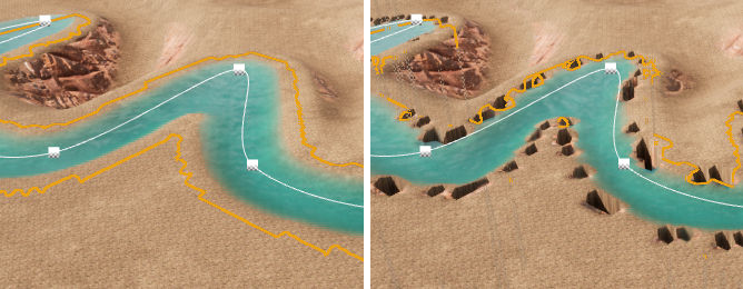
Unreal Rivers And Illusory Lakes
Back to the water. The kind of image below is kind of exemplary for the kind of problems I run into with the Water System, even when I put aside any problems my landscape sculpting itself have caused:

The rivers do connect nicely to each other, to the volcano lake and to the ocean (not here, though). In general, that’s an immense ease of use.
But I don’t get the channels the objects are carving have their width and depth to work reliably together – so my river deltas kind of taper out before they even reach the ocean. (I assume as the river branches, the water volume stays more or less the same, so the individual branches should be shallower and – judging from the original map – narrower than the »main« river.)
WaterBody object splines can have Curl noise added to make the river bend more randomly. But that causes weird artifacts along their edges, the kind of which I have read about somewhere when the landscape was scaled to something other than 1.0, which I took care that mine is not. (It’s a quite early feature, this Water System).
This all – deltas, river shape noise, shoreline – starts to become a bit overwhelming, so I put it to the back of my mind and instead start dabbling around with landscape materials and foliage population …
Leave a comment
Log in with itch.io to leave a comment.